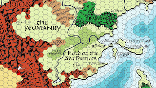
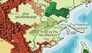
Over on the Flanaess Geographical Society facebook group, I noticed that Zach Henderson started to post a clean up of the original Darlene Greyhawk map. One of the things he did was to go through the map with Photoshop and removed all the hexes. A monumental task.
I realized that you could digitalize that version and make a crisp clean copy of Darlene's original Greyhawk map. I started talking with Zach and it turned out he broke up his work out into layers. We exchanged files and I started to digitalize the text, fills, and symbols.
Using a variety of tools managed to turn nearly everything on Darlene into a vector. This allow arbitrarily small or large maps to be made from the file. Plus you get a smaller file size for various resolutions.
I then added a few requested bells and whistles like 6 mile hexes, and a black and white version.
I was able to export as SVG file containing most of the map. The only thing that didn't come through are the forest and mountain drawings. The digitization of those layers did not translate well into a SVG file. But I managed to export the rest and sort it into proper layers usable with the free Inkscape illustration software and most other illustration and mapping programs.
This is released under the Wizards Fan Content Policy and the few original elements I have are released under the CC-BY-SA-NC 4.0 license.
The main file is a layered PDF. In testing this I found many PDF readers to be hit or miss on their ability to turn layers off and on. Adobe Reader definitely works.
Digital Darlene Greyhawk Map (PDF and JPGs)
Rob's Note: I been received errata on the map. I uploaded the fixed PDF. It is Rev 12b. Appreciate everybody who sent me errata on Christmas Eve.
Rob's Note #2: I applied more errata. Fixing up settlement symbols because of the lack of clarity in the original scan. Also restored the missing i in White Fang Bay. Finally I sorted out the issue with the mountain and forest fills in the SVG file. They are now present. The PDF and SVG are now Rev 12c. The JPGs been all updated.
Here is a jpg export of the full map.
Digital Darlene Greyhawk Map (JPG)
Everybody have a happy and safe holiday and Merry Christmas to one and all.


47 comments:
Fantastic Rob! These look really excellent.
Stunning work!
Brilliant! This is exactly the kind of community engagement I hoped for when I started the project.
This has been- and I hope continues to be a fun and very satisfying collaboration.
Thank you, sir, for your hard work!
A Conley-ized take on the Darlene Greyhawk map. YUM!!
Thanks, the Darlene map is essential to me!
I am glad to see your take out there as a bitmap scan will be more accurate than a digitized version. And it was great working with you on this Zach!
You guys have done an amazing job! The black and white one in particular gives me ideas for map projects based off that. Thanks a million for the downloads.
Whata gift! Thank you!
Fantastic work!
Thank you!
Stunning! Thanks for your amazing work!
I love playing around with the various layers in inkscape. I noticed that in the SVG texture for mountains and forrests seems to be missing, or might that be a rendering problem on my side?
Happy Holidays everyone!
@Wanderer Bill, the forest and mountain texture got mangled in the SVG export. So I had to delete those layers. I am working on fixing that. It willl take time tho.
Absolutely beautiful!
Added to the Blog Database.
https://jonbupp.wordpress.com/for-dungeon-masters/multiverse/worlds/greyhawk/
@Jon, thanks!
Is there perchance a way to get the greyscale map without the hex like it is on the preview? that preview makes it look like a thing of beauty straight out of a fantasy novel
@Dreamakuma, you should be able to achieve the look with the pdf file. Adobe Reader or others which support layer viewing should enable you to customize the output. I found the look are after by making the following layers invisible: Hex layers, Forest Trunks, Desert Plains Wastes, Mountains Solid, Hills Solid, Swamp, Ground, Water Contours, and Water. Robert might correct me if I've missed something.
@Zach Yup that correct.
@Dreamakuma, I added your request to the zip file.
Thank you so much!
Thank you so much. I have zero skill playing with this stuff. I want to create a six-mile map centered on Verbobonc/Narwell/Enstad/Dyvers. How do I zoom in on that section, select the region, and then print it out (so that I can populate the hexes)? Thanks for any help! Merry Xmas
Mark
@Henry
1) Zoom in with your PDF or JPG viewer
2) Print Screen (using the Print Screen button on your keyboard
or
2) Use a Screen Capture utility
3) Paste into MS Paint (or your OS Paint program)
4) Print
Thanks so much, Rob! Happy New Year!
It's gorgeous!
Not to be a party-pooper, but I noticed that WHITE FANGED BAY is missing the I.
Otherwise, this is a spectacular piece of craftsmanship.
Phenomenal. Well done.
Great work! Many thanks!
Thank you!, this is a great chrismast gift!
Incredible work! This is such a godsend for my current campaign!
Would it be possible to get the maps in PNG format also? Having them in image formats is a lot easier for working with quickly (say snipping out a region for example) but the artifacting on the JPGs, especially the 6mi hexes, is pretty bad.
I also did notice that the place where the Davish and Javan rivers meet by Sterich came out looking like a thick black triangle. Not sure if that was intentional.
Thank you so much for bringing Greyhawk into the future. Very much appreciated!
Anyone know how large the resolution can go to print the map at Kinkos or Office Depot, is 36x36 or 24x24 possible?
with the pdf as big as you want. It is vector based.
Hello !
Thank you very much for this excellent work!
everything is really great, but I especially like the svg format.
Do you think it is possible to make a version without any text?
This would allow non-English speaking players to recreate the map for their players...
Anyway, great work
Thanks for your attention
@KMSCHMZX
The download has a SVG file that compatible with Inkscape and other illustration programs. It is layered and all vectors. So does that work for you? You can just hide or delete the current text layer or even selected text. Then sub in your language specific text.
Likewise the PDF has no security on it, vector based, and has layers. So you could use illustrator to open the PDF, or Adobe Acrobat and edit it. Even if you only have Adobe Reader or another PDF software, the PDF is layered so you can turn off the text layers and save the results as a jpg or other graphic file format.
Let me know if that works for you.
Yes !
Thank You !
How is this not the top search return on Google? My return to D&D is marked by a "Return to Greyhawk" and going back to the older rules sets (OSE). Thank you for such a fantastic resource.
Appreciate the compliment and glad you enjoyed it.
Rob is there an editable version? I would like to make changes to fit my person campaigns as needed, such as realm names.
In the download here
https://www.batintheattic.com/downloads/greyhawk/World%20of%20Greyhawk,%20Digital_Dec_24.zip
There is this file
World of Greyhawk, Darlene, Rev 12c.svg
You can edit it with Inkscape or any vector drawing file that can import SVG files
https://inkscape.org/
This is beautiful. I may print it in a wide printer to hang on my wall. Greyhawk was never published in my country so I never had access to the original map.
The original map had a coordinate system, that was referenced in the locations of all adventure modules that took place in Greyhawk, could you do a version with the letters-numbers coordinate system?
@Hackbarth I will see what I can come up with.
This work is worth of a good and sincere standing ovation. Thank you so much for all the quality work, passion and hours it took you to complete this piece.
Hello Robert, thank you for the amazing maps! Can you please upload a colored map with no hexes (jpg or pdf)? Currently the only map in the package without hexes is grey.
Download the map again it now has a color version with no hexes.
Just be aware that the PDF is layered so you can turn off the hexes on the color version. You can then either print or in most PDF readers save it as a jpg or png. The layers also allow you to make other custom versions of the map.
Thank you! The color version with no hexes works perfectly. And I just tried turning the layers on and off in the full version (earlier I was using a PDF reader that didn't support that). Mind-blowing! Thank you so much.
You are welcome and glad it worked out for you.
Thank you for sharing this amazing work! I have a question, if you don't mind? I opened the svg file labeled "World of Greyhawk, Darlene, Rev 12c.svg" from your zip file in Inkscape, and I noticed that the forest icon/path layer for the Burneal Forest seems to possibly be missing (only the flat green "trunk" layer is showing). I went through the layers to see if there were any layers set with the eye closed icon, but couldn't find it. Is it possible I'm overlooking something? Here's a screencap of what I'm seeing:
https://i.postimg.cc/k4m1WQkM/burneal.jpg
Thank you for you time.
I will get that fixed up. Thanks for letting me know.
@Jaycee Baron Download the zip file again. There is now a 12d SVG file with the Burneal Forest fixed. For some reason it wouldn't export so I had to do some creative exporting to get that part in. Weird.
Thank you, sir!
Post a Comment